| Phan Rang Air Base, Vietnam | home |
| back to Introduction |
| Aerial Photos |
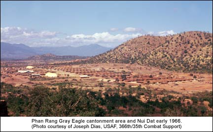
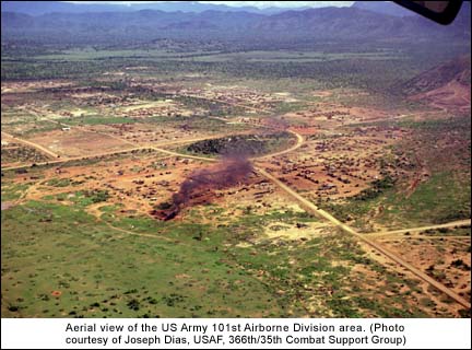
In the photo below the Gray Eagle area can be seen looking south with Nui Dat bordering the right edge of the cantonment area. Beyond the south end of the base is the US Army’s 101st Airborne Division base area. The photo would have been taken prior to combat aircraft arrival – probably in early February 1966. Note there is no road leading up to the top of Nui Dat.
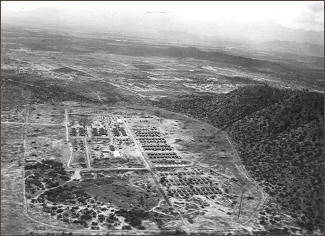
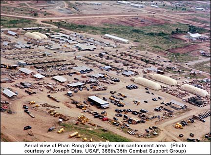
The photo reflects the 1100 man Gray Eagle support package with temporary hooches for barracks facilities and offices, inflatable warehouses for supply and materiel storage, the base civil engineering storage yard and the motor pool maintenance area. Bare concrete pads at the center lower right in the photo reflect where new hooches will be constructed. The hooch area at the bottom of the photo was the initial Red Horse barracks area when that element arrived. This was temporary, as the Red Horse would locate to the area below the Officers Club hill at left center up. The various arriving maintenance and other support squadrons then occupied the vacated hooch area as the base population grew.
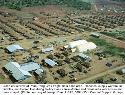
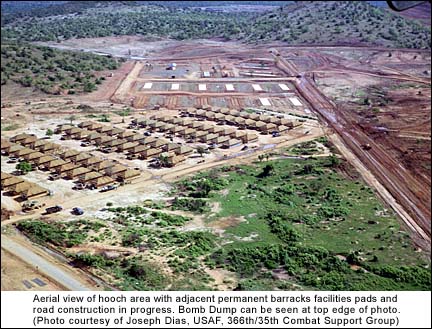
The following photo reflects the Phan Rang Gray Eagle base looking to the west probably in mid to late October 1966. Noticeable is the constructed road now leading up to the summit of Nui Dat, accomplished in mid July 1966.
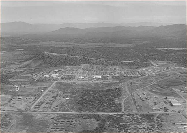
Other changes noted are the addition of several other inflatable supply warehouses, and hooch construction continuing to the base of Nui Dat. Concrete pads for the initial permanent barracks facility can be seen at the right edge of the photo. Also just above that location, the south end of the munitions storage area can be seen just over the lower lying hills. At center right the pilot air conditioned living quarters (curved line of buildings) are visible, with the Red Horse area below that. The long Quonset huts in the lower right of the photo are part of the RMK base construction contractor facilities.
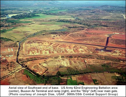
This aerial photo would have been taken in late summer 1966 prior to movement of F-4 aircraft to DaNang. This is the original flight line at Phan Rang with F-4 and F-100 aircraft.
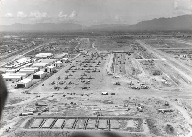
Maintenance hanger and shop facilities have been constructed. Ramp enlargement is underway and fuel bladders and refueling vehicles are visible at the bottom of the photo. The ramp area above main ramp is the old Busson airstrip and the then aerial port facility at its end and to the left. This older ramp area also served as base for the HH-43B Air Rescue unit, an Army Huey helicopter company, and an Air Force O-1 aircraft Forward Air Control unit. The Cham Po Klong Garai temple can be seen at the left above center edge of the photo on the road to Thap Cham village. The US Army 62nd Engineering Brigade, Phan Rang Main Gate, and the "Strip" were on the road leading towards the temple.
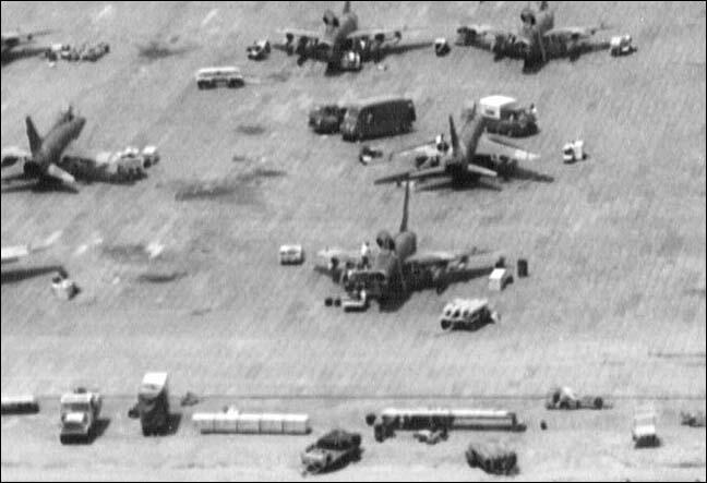
Flight line close-up view of F-100 aircraft being uploaded with munitions and readied for combat missions. Flight line equipment in picture includes MJ-1 Bomb Lift trucks and bomb trailers laden with assorted air munitions. Maintenance vehicles can be seen on the ramp and personnel on and under aircraft. Grid looking lines on the ramp are the aluminum AM-2 interlocked matted panels.
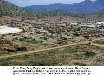
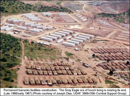
This photo reflects the end of the Phan Rang "Gray Eagle" period. Significant change can be seen in permanent facilities construction and expansion of the base into the 101st Airborne Division location. The photo again looking south was probably taken in the late December 1966/January 1967 time period.
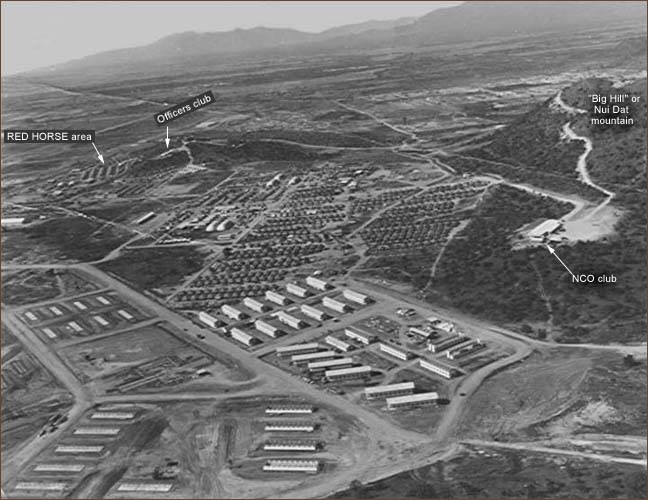
The hill locations of both the Officers and NCO Clubs can be seen. The hooch areas have expanded to the base of Nui Dat as more and more personnel arrive. Personnel will begin occupying the permanent barracks facilities as they are completed. The Red Horse area can be seen at left upper center down hill from the Officers Club.
Aerial Photos courtesy of Joseph Dias, USAF, 366th Combat Support Group
Additional Aerial Photos